|
| English | Français |
|
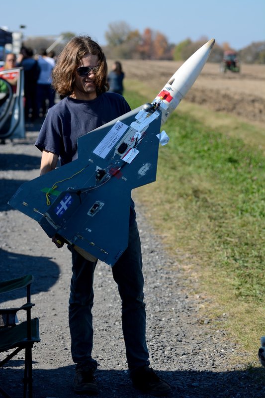
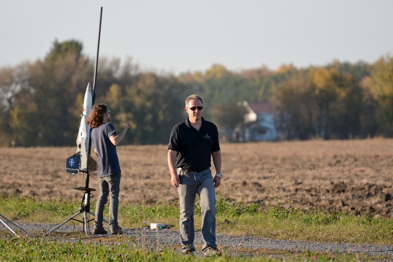
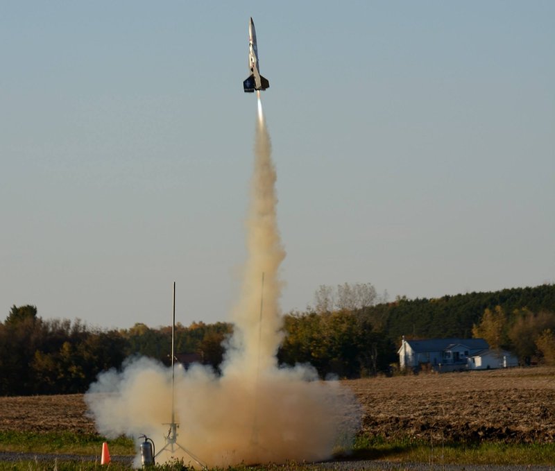
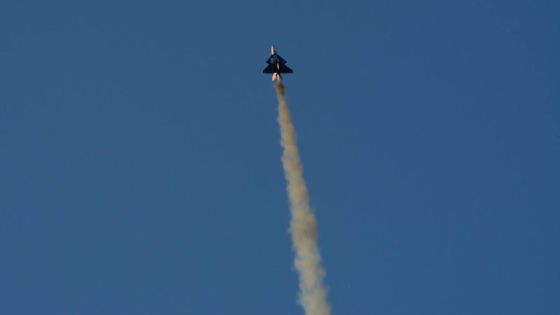
Ciel D'Octobre 2013 - St-Pie-de-Guire, Québec
|
|||||||||||||||||||||||||||||||||||||||||||||||||||||||||||||||||||||||||||||||||||||||||||||||||||||||||||||||||||||||||||||||||||||||||||||||||||||||||||||||||||||||||||||||||||||||||||||||||||||||||||||||||||||||||||||||||||||||||||||||||||||||||||||||||||||||||||||||||||||||||||
- St-Pie-de-Guire - Canadian Assocation of Rocketry - October 12th & 13th 2013 - 6000 foot ceiling - 1 square Km area to fly - Motors from "A" to "M" 2013/10/10 Final weather check The data for the weekend has stabilized. It appears we are falling right in the middle of "indian summer" with daytime highs reaching 20C and night time low... [More Weather Info] Full Google Map, coming from the Eastbound 20: http://goo.gl/maps/JEmd5 Google maps view of launch site access road: http://goo.gl/maps/KZKsQ The first step is to reach autoroute 20 on the south s... [More Location Info] |
|||||||||||||||||||||||||||||||||||||||||||||||||||||||||||||||||||||||||||||||||||||||||||||||||||||||||||||||||||||||||||||||||||||||||||||||||||||||||||||||||||||||||||||||||||||||||||||||||||||||||||||||||||||||||||||||||||||||||||||||||||||||||||||||||||||||||||||||||||||||||||
|
Weather status & forecast updates 2013/10/10 Final weather check The data for the weekend has stabilized. It appears we are falling right in the middle of "indian summer" with daytime highs reaching 20C and night time lows dropping only as low as 10C. The wind data appears steadier than originally forecasted, averaging 8km/h all weekend with slight increases and decreases, with Saturday afternoon and all day Sunday being the best times to launch. The wind will however perform a 90 degree or more shift over the weekend, blowing first from the east, then shifting from the south blowing generally northward. According to this final report we are clearly GO for October Sky 2013. 2013/10/07 Weather status update The WIND forecast has been increased for Saturday. Put aside the unchanged forecast parameters (sunny, warm, low precipitation odds) it appears that the wind may blow between 15-20km/h (20km/h gusts are forecasted) on Saturday, then fall to as low as 5km/h on Sunday. The temperature forecast has improved by two degrees, providing for maximums anywhere between 16 ad 20 degrees celcius! The event weather status remains POSITIVE. 2013/10/04 Preliminary report So far it seems the weather will cooperate for the weekend of the 12 and 13. The temperatures may actually be slightly warmer than last year's October launch, providing for some more comfortable activities. Wind should be blowing at around 10km/h all weekend... a number derived from the average between sustained winds and gusts. The gusts themselves should not pass 15km/h, posing absolutely no problem at all for rocketry. Camping will be allowed on site but we recommend you equip yourself well: temperatures are expected to fall under 10 degrees during night time. Winter sleeping bags are strongly suggested. Up to this point the weather is looking fine for the next launch. We will release a final report early next week. The weather status is currently POSITIVE Phase 1 long & moyen terme / Phase 1 long & mid term http://www.meteomedia.com/fourteenday/caqc0650 http://www.accuweather.com/en/ca/drummondville/j2b/month/50016?monyr=10/01/2013 http://www.weather24.com/16days/r/Drummondville/Quebec/Canada/CA5942845 http://www.myforecast.com/bin/expanded_forecast_15day.m?city=54145&metric=true Phase 2 court terme / Phase 2 short term http://www.intellicast.com/Local/Weather.aspx?location=CAXX0672 http://www.weather.com/weather/weekend/CAXX0672 http://www.foreca.com/Canada/Drummondville?tenday http://www.wunderground.com/cgi-bin/findweather/getForecast?query=drummondville Phase 3 révision finale / Phase 3 final revision http://www.windfinder.com/forecast/nicolet_lac_saint_pierre http://www.weatheroffice.gc.ca/city/pages/qc-2_metric_e.html http://www.acukwik.com/weather/CSC3 http://www.stormsurfing.com/cgi/display_alt.cgi?a=watla_precip (Tryout - for precipitation) http://www.stormsurfing.com/cgi/display_alt.cgi?a=watla_slp (Tryout - for wind) |
|||||||||||||||||||||||||||||||||||||||||||||||||||||||||||||||||||||||||||||||||||||||||||||||||||||||||||||||||||||||||||||||||||||||||||||||||||||||||||||||||||||||||||||||||||||||||||||||||||||||||||||||||||||||||||||||||||||||||||||||||||||||||||||||||||||||||||||||||||||||||||
|
Post-event description |
|||||||||||||||||||||||||||||||||||||||||||||||||||||||||||||||||||||||||||||||||||||||||||||||||||||||||||||||||||||||||||||||||||||||||||||||||||||||||||||||||||||||||||||||||||||||||||||||||||||||||||||||||||||||||||||||||||||||||||||||||||||||||||||||||||||||||||||||||||||||||||
Web links, pictures, documents & more
|
|||||||||||||||||||||||||||||||||||||||||||||||||||||||||||||||||||||||||||||||||||||||||||||||||||||||||||||||||||||||||||||||||||||||||||||||||||||||||||||||||||||||||||||||||||||||||||||||||||||||||||||||||||||||||||||||||||||||||||||||||||||||||||||||||||||||||||||||||||||||||||
|
Location information & directions Full Google Map, coming from the Eastbound 20: http://goo.gl/maps/JEmd5 Google maps view of launch site access road: http://goo.gl/maps/KZKsQ The first step is to reach autoroute 20 on the south shore of Montreal. For local residents, this is pretty easy. If you don't know how, just check a Quebec map! 
Take autoroute 20 East towards Drummonville. Take Exit 175 and take the 143 north. 
On the 143 (north), go through the village of St-Bonaventure (there are two consecutive right angle turns in the village itself). 
- Turn right on the "2e Rang" - Roll on the "2e Rang" for 0.8km - Turn Left on the "10e Rang" - Roll 4.4km on the "10e Rang" The launch site is on your left (western side of the road - a dirt road to be exact). Look for a sign that shows "TRIPOLI-QUEBEC FUSEES" including orange cones and follow the instructions on the placcard. If you see an airplane hangar, you're too far. Turn back and roll for about 200 meters. 
Full Google Map, coming from the Eastbound 20: http://goo.gl/maps/JEmd5 Google maps view of launch site access road: http://goo.gl/maps/KZKsQ |
|||||||||||||||||||||||||||||||||||||||||||||||||||||||||||||||||||||||||||||||||||||||||||||||||||||||||||||||||||||||||||||||||||||||||||||||||||||||||||||||||||||||||||||||||||||||||||||||||||||||||||||||||||||||||||||||||||||||||||||||||||||||||||||||||||||||||||||||||||||||||||
Launch log
|
|||||||||||||||||||||||||||||||||||||||||||||||||||||||||||||||||||||||||||||||||||||||||||||||||||||||||||||||||||||||||||||||||||||||||||||||||||||||||||||||||||||||||||||||||||||||||||||||||||||||||||||||||||||||||||||||||||||||||||||||||||||||||||||||||||||||||||||||||||||||||||